Spatial Information Science (SIS)
SIS: Collecting, processing, analysing and visualising data to produce and validate spatial information while being acutely aware of the provenance of the data (its metadata) and data uncertainty.
Soundscape ecology is a developing research field where interactions between sounds and the environment are studied.
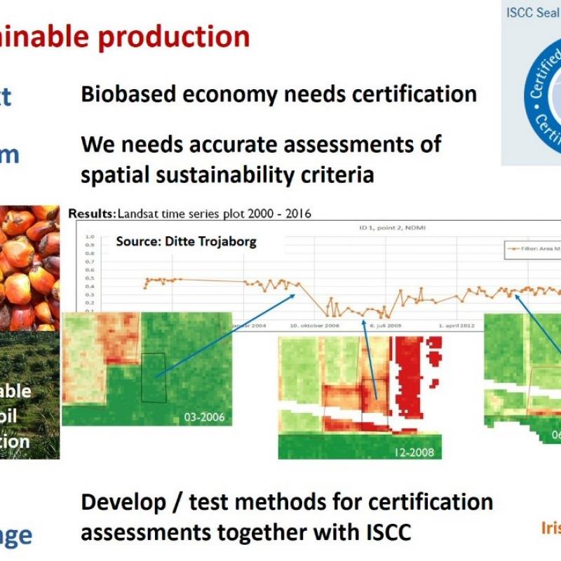
Palm oil is an important vegetable oil.
Protected areas are useful governance tool to mitigate biodiversity loss and preserve threatened habitats and species.
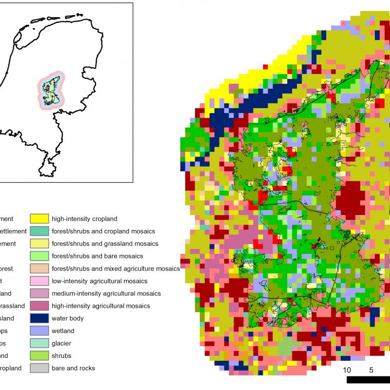
About 75% of the Earth’s land surface has been altered and land use change has affected more th
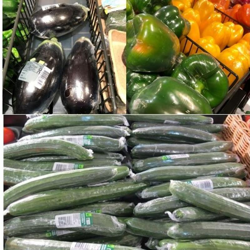
Food packaging is responsible for 5.4% of global food systems emissions in 2015 (Crippa et al.,
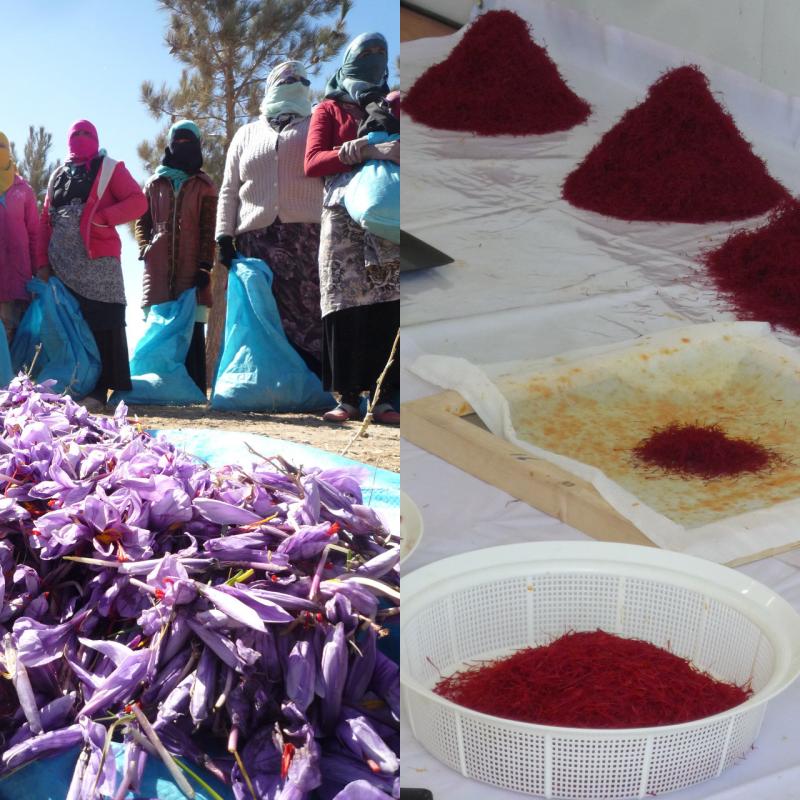
Saffron is the most costly spice by weight worldwide, and an important ingredient for Middle-Ea
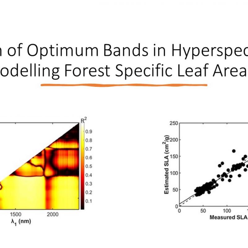
The goal of this study, as part of the larger BIOSPACE project, is to map and model Specific Leaf Area (SLA) and its spatial variation in
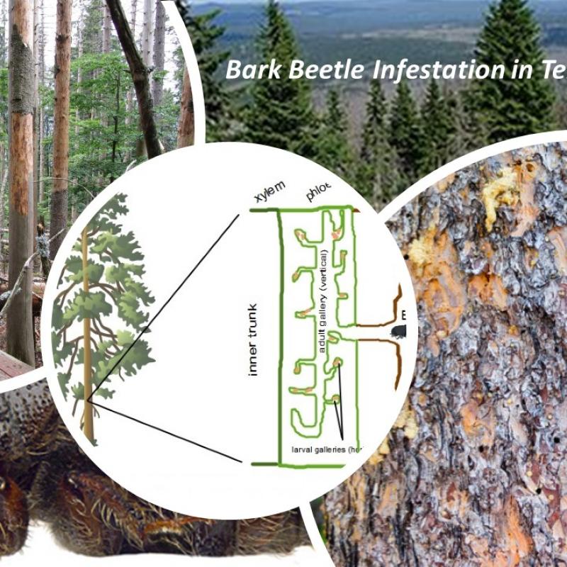
The goal of this study is to detect and map bark beetle infestation in a temperate forest in Germany using DESIS hyperspectral satellite
The past decades have seen rapid advancements in space-based monitoring of essential water cycle variables, providing products related to precipitation, evapotranspiration, and so
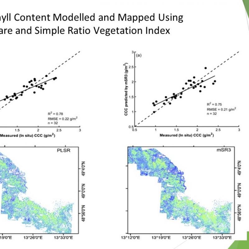
The goal of this study, as part of the larger BIOSPACE project, is to map and model foliar pigments, including chlorophyll and caroten