Spatial Information Science (SIS)
SIS: Collecting, processing, analysing and visualising data to produce and validate spatial information while being acutely aware of the provenance of the data (its metadata) and data uncertainty.
LINK TO RESEARCH PROJECTS
The MSc topics link to several ongoing larger research projects that allow being part of international research teams - both projects just started:
The droughts of 2018-2020 in the Netherlands created great social distress, induced huge economic damages in agricultural production, disrupted river navigation and damaged buildi
Water resource management needs to consider a wide range of spatial scales and address a variety of problems, e.g.
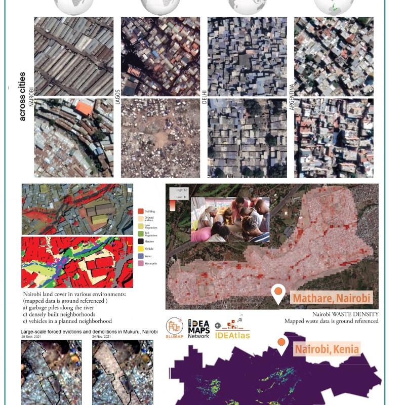
The use of printed satellite and aerial images for spatial data collection has been prevalent in many participatory geography approaches.
The so-called Right to Light in Great Britain, the European standard EN 17037 “Daylight in Buildings”, and similar design codes or standards of good practice provide recommendations for ensuring th
The new Surface Water and Ocean Topography (SWOT) satellite, launched in December 2022, aims to map Earth's water in unprecedented detail to help manage climate change and to shar
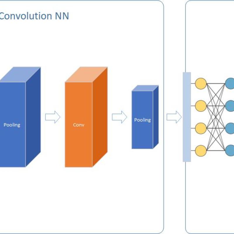
Deep Neural Networks (DNN) is considered as a panacea for different problems in several application areas. But what about spatial modeling?
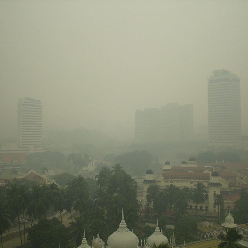
To model air pollution in urban environments while accounting for urban forms using convolutional neural networks (CNN) or Vision Transformers (ViT), open access earth observation
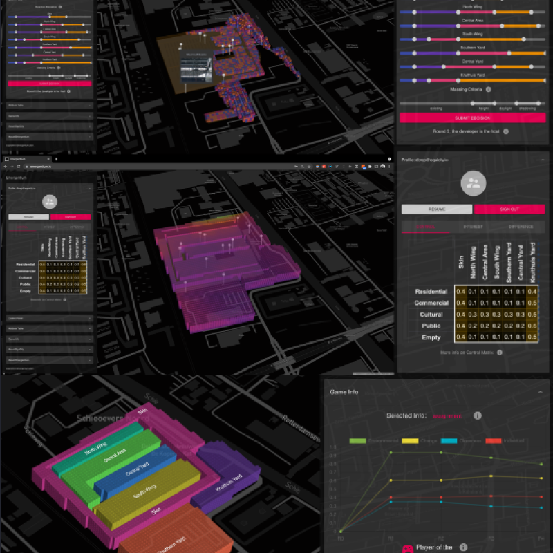
The decisions made on the spatial configurations and distributions in the built environments (urban or rural developments) directly affect the environment as well as the interests of various stakeh
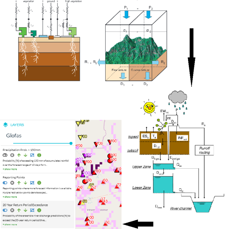
GLOFAS is an ensemble of 3 components: A Metrological Model and Forecast (Numerical Weather Prediction (NWP) forecasts of the ECMWF IFS), A hydrological model (LISFLOOD) and a web