Extraction of Sketched data from Printed Orthophoto Maps using image difference operators and structural image registration
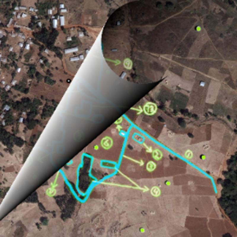
The use of printed satellite and aerial images for spatial data collection has been prevalent in many participatory geography approaches. We use the term participatory geography for lack of a better, all encompassing term. In particular, many participatory land tenure mapping projects use this approach to obtain boundary data for land parcels. To support this process, several image processing approaches have been investigated to allow for the automatic extraction of the drawn ink from scans or photographs of the annotated orthophoto maps. This problem has however not been successfully resolved. No out-of-the box tools exists for achieving this task and those tools that exist either assume the annotation ink is drawn on a transparent overlay.
This topic would investigate a solution to the aforementioned challenge by evaluating different image registration techniques and image difference operators. Image registration is suggested in this topic as an approach assign pixels of the target (base) image to the input image (scanned and annotated, also known as moving image) . Image difference operators such simple pixel-wise subtraction can then be used do eliminate original ink to obtain the annotations' ink in isolation. While techniques exist to post-process such the output pixels into stroke information, that would be outside the scope of the study.
Several objective could be explores by the student; In terms of questions, one question to explore is how structurally aligned images where one image contains annotations or "noise" can be subtracted to isolate the noise. But of course, before this one must first be able to find the structural alignment (image registration). A study could stop at this point (of structural alignment) with an appropriate means of measuring the structural alignment (e.g. precision and recall).
For either task, simplifying assumptions must be made such as e.g. minimal image intensity and geometric distortion between input and target image corresponding pixels. The idea would be to start with two exact copies of an image, experiment with different methods, and gradually introducing distortions in an iterative process
- Take two exact copies of an image(s) as the base case input;
- Solve the problem with different methods for the base case;
- Introduce a distortion in the moving image and use the resulting two images as the base case for the next iteration;
- Repeat from step 2.
Collecting, processing, analyzing and visualizing data to produce and validate spatial information while being acutely aware of the provenance of the data (its metadata) and data uncertainty.