Spatial Information Science (SIS)
SIS: Collecting, processing, analysing and visualising data to produce and validate spatial information while being acutely aware of the provenance of the data (its metadata) and data uncertainty.

One of the aims of conservation and rewilding groups in Europe is to assess whether natural grazing l

Brazil is the biggest coffee productors in the world, with millions of hectares of plantations.
Mapping and monitoring slums is essential to ensure the sustainable development of the cities to ensure a quality of life for people.
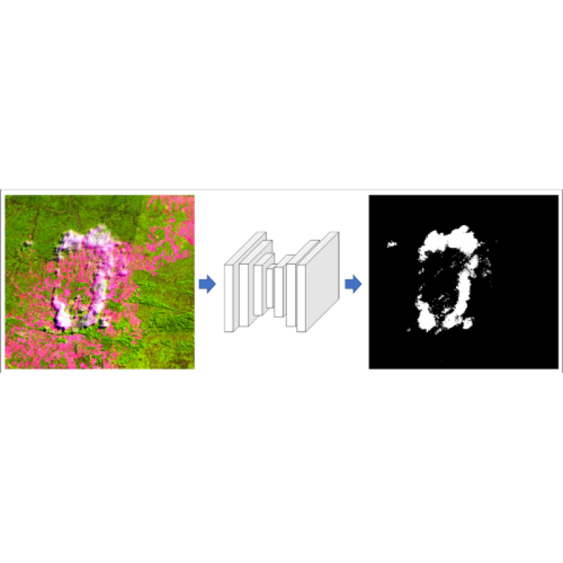
Clouds usually represent a big problem for optical remote sensing.
Understanding the types of vegetation that composes the land cover on non-anthropic areas and the land use for anthropic areas is essential to understand e
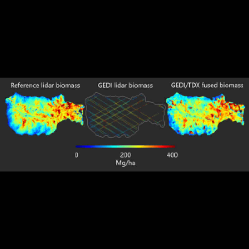
Estimating aboveground biomass is essential for generating vegetation inventories and understanding carbon cycles.
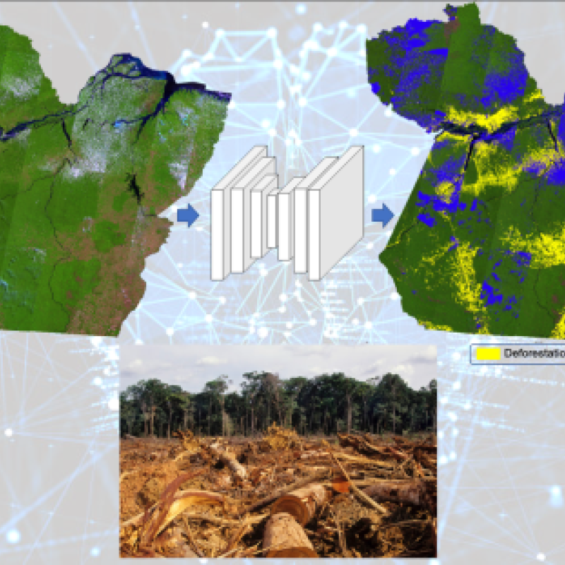
An accurate method for automatically mapping deforested areas constitute an important tool to inform and enable deforestation containment policies.
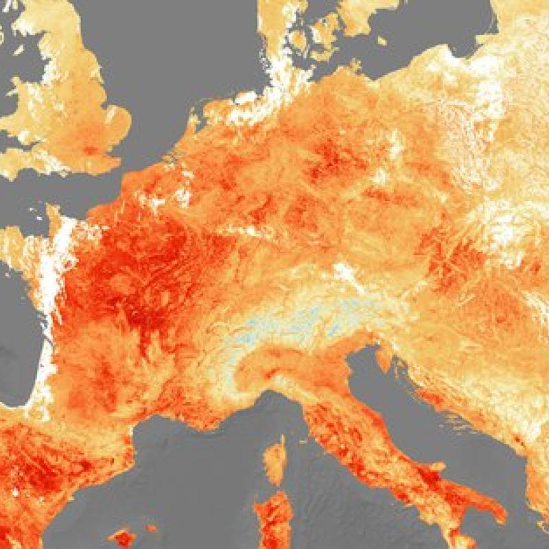
Droughts are exacerbated by climate change, which makes them more frequent, prolonged, and catastrophic.

As an essential part of food security, diet diversity often requires frequent household food security surveys to monitor.

Sufficient nutrition remains a major challenge for rural households in the Sub-saharan region of Africa.