Spatial Information Science (SIS)
SIS: Collecting, processing, analysing and visualising data to produce and validate spatial information while being acutely aware of the provenance of the data (its metadata) and data uncertainty.
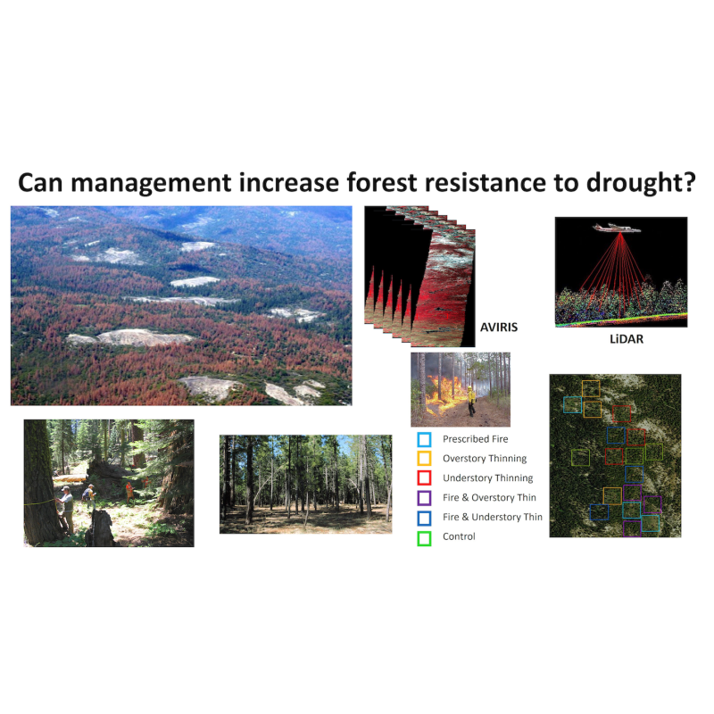
Mediterranean and temperate forests are being affected by intense and frequent droughts that will become mo
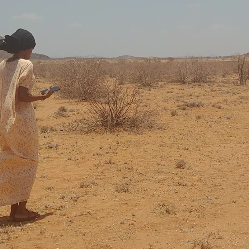
The arid and semi-arid Lands (ASALs) of northern Kenya are characterized by extremes of poverty and c
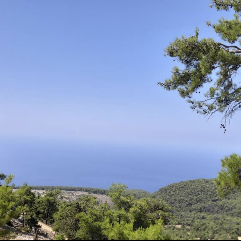
Recently, mortality and reduction in forest stand densities for Brutia pine (Pinus brutia) h
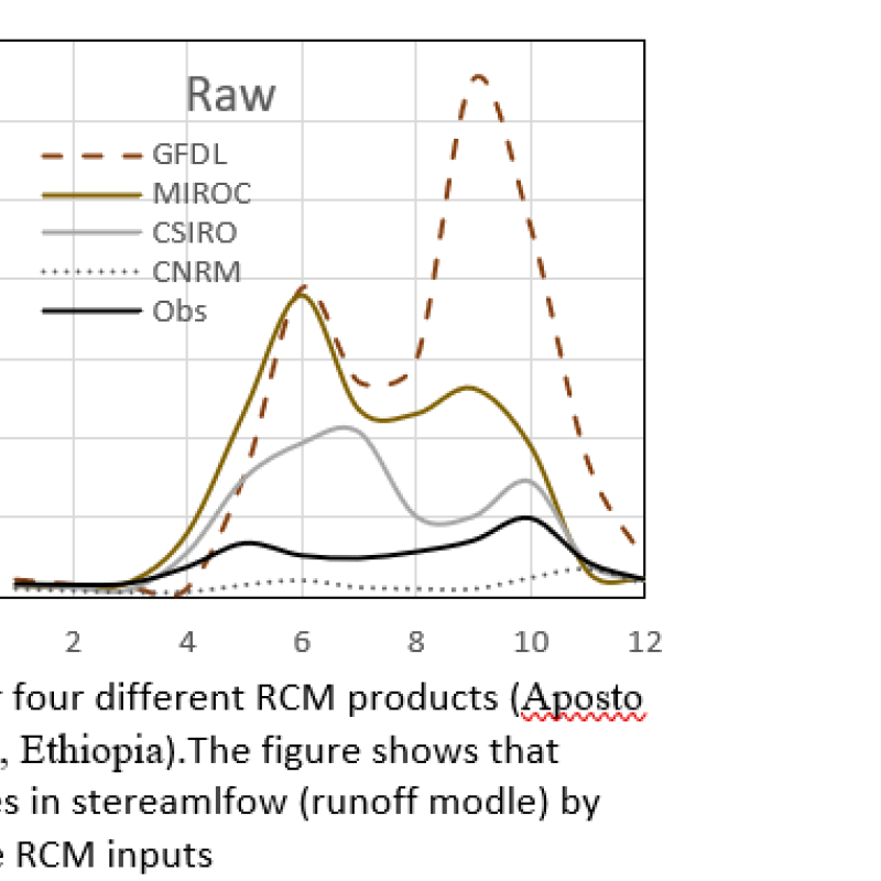
Rainfall data series from climate models (i.e.
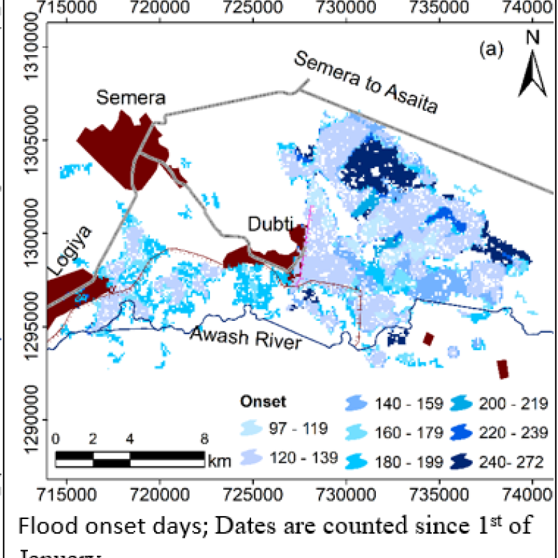
Synthetic-aperture radar (SAR) data from Sentinel-1 satellites provides unprecedented opportunity to evaluate inter-annual flood characteristics, although consen
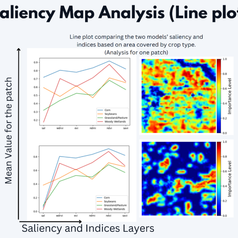
The accurate prediction of crop yields is a critical element in ensuring global food security, managing agricultural markets and supporting the decision-making processes of farmers and
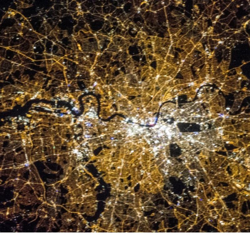
The majority of the Earth Observation missions focus on daytime monitoring.
Water level in lakes and rivers is a critical parameter to monitor for water managers. It captures the state of surface waters, and, if placed strategically, can be used in e.g.
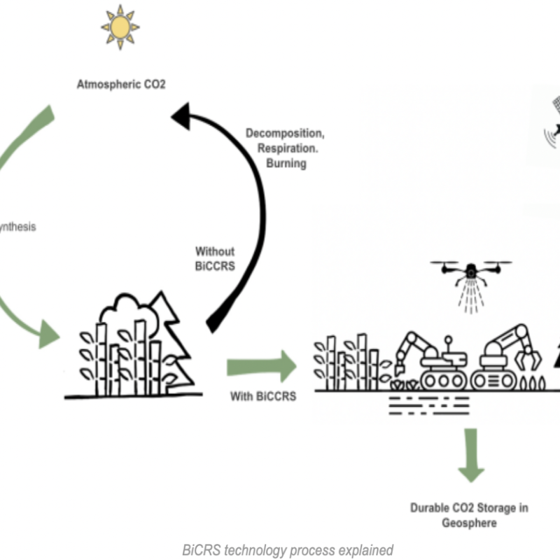
The Intergovernmental Panel on Climate Change (IPCC) estimates the global community must remove up to1000 billion metric tons of carbon dioxide (GtCO2) by 2100 to limit warming to no more than 1.5°
Forest health worldwide is increasingly deteriorated by droughts.