The use of maps in railway journey planners
Why are maps not often used in railway planning apps? What is the (potential) role of maps in railway journey planners, and what do users need?
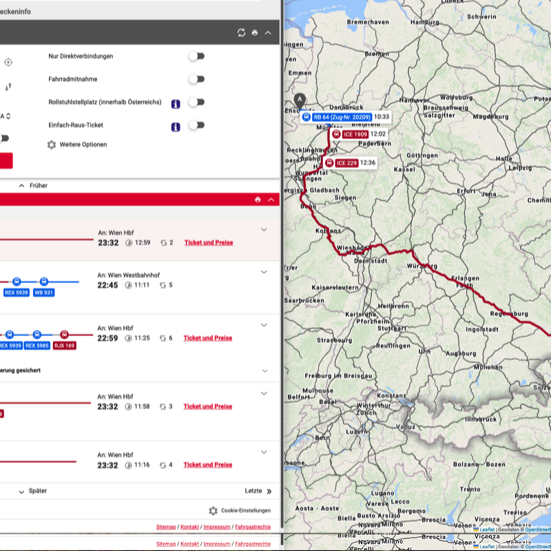
All car journey planners use maps in all phases of the planning progress, but almost all existing railway planning apps use maps only limited or not at all. One of the most established ones (https://bahn.de) did show maps of routes in the past, but its most recent version only has very limited maps. One of the few exceptions seems to be the Austrian Railways planner (shown in the screenshots above and below - https://fahrplan.oebb.at).
In this thesis, we want you to explore the role of maps in railway planning applications. Find out what theoretically could be the use of maps, and what the current status is.
Depending on your interest, the next phase could be focussed on experimenting with better ways of integrating maps, or creating alternative types of map (eg. using schematic maps [2]). Or on finding out how users actually use maps in such planners, and what their needs and expectations are, or on a combination of the two...
- Cherry, C., Hickman, M., and Garg, A. (2006). Design of a map-based transit itinerary planner. Journal of Public Transportation, 9(2):45–68, DOI: https://doi.org/10.5038/2375-0901.9.2.3
- Guo, Z. (2011). Mind the map! the impact of transit maps on path choice in public transit. Transportation Research Part A: Policy and Practice, 45(7):625–639.
- Peng, Z.-R. and Huang, R. (2000). Design and development of interactive trip planning for web-based transit information systems. Transportation Research Part C: Emerging Technologies, 8(1):409–425, DOI: https://doi.org/10.1016/S0968-090X(00)00016-4

