Finding, monitoring and creating acceptance for geothermal resources for the energy transition
Suggested elective courses (s):
- Depending on exact topic definition: possible are Geophysics, Thermal Infrared (for geologic topics), python programming (for scripting) ….
Additional remarks:
A Planning related topic could possible answer the following research questions:
- what would be the implications for the energy plans of enschede? What are the links to Twence, etc.? Who would "get" the heat, what impact could it have on the plans for the city/region? Also potential public concerns about the safety/etc. could be looked into.
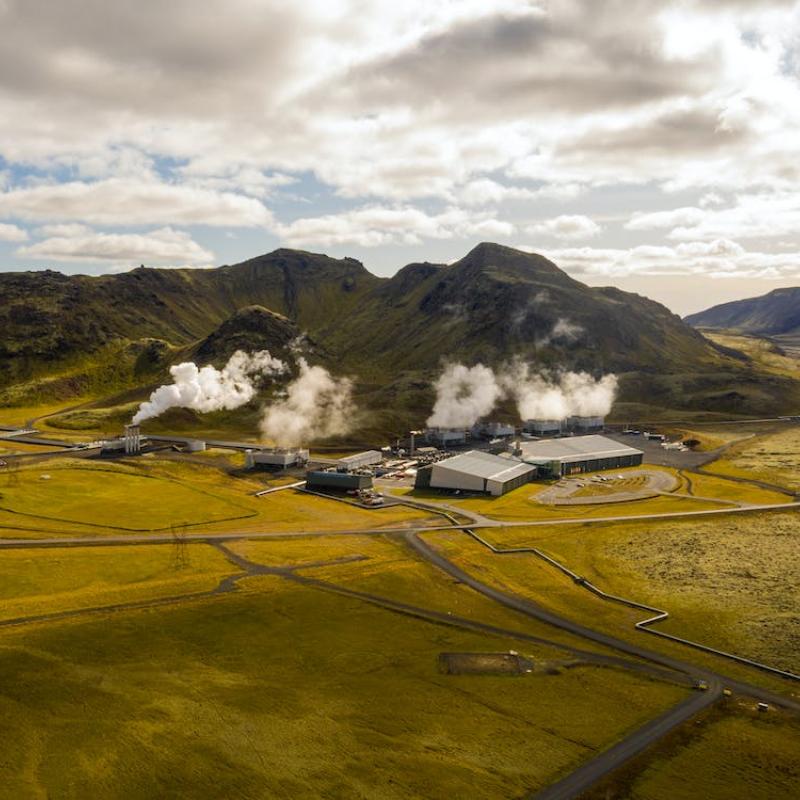
Geothermal systems are one of the sustainable sources of our future energy mix. High temperature systems can be used for electricity production, while lower temperature systems are useful for heating buildings or for industrial heat applications. To find the locations where geothermal resources occur in the subsurface is a challenge with very high associated (drilling) costs if unsuitable locations are selected. Additionally, the best location from a resource point of view, may not work in terms of surface infrastructure or public acceptance and a viable project may get shelved due to public resistance to the development.
To make the best decisions possible, we need to make use of multiple data sources and the latest technology. These can help to: a) pinpoint locations where surface manifestations show possible geothermal resources in the subsurface, b) characterize the subsurface (i.e. reservoir characteristics) for physical and chemical parameters or c) include the general public in the decision making process to increase public acceptance of the development.
Potential supervisors
Chris Hecker, Arjan Dijkstra, Frank van Ruitenbeek (all geology), Mark van der Meijde and Islam Fadel (geophysics), Cheryl de Boer (spatial planning and stakeholder involvement), Harald van der Werff (time series analysis of fumaroles).
Multiple research direction are possible. Examples could include:
- the mapping of different alteration minerals in drill cuttings or drill cores of Indonesia or Kenya to characterize the fluid chemistry and the pressure/temperature conditions and help exploration efforts in that respective geothermal system.
- Finding, characterizing and monitoring of geothermal surface manifestations (e.g. fumaroles) in Indonesia or East Africa with different remote sensing tools, such as spaceborne, airborne and drone-based Thermal Infrared systems, time series analysis etc. to help map and monitor geothermal activity at the surface.
- Determine the permeable target zones north of the UT campus with hyperspectral core scanning on existing drill core to help establish if (and where) a geothermal well could be established from a geologic point of view to help heat the UT in the future.
- Determine ideal drilling locations for a geothermal well on the campus from a technical, economic as well as public support perspective (including the social acceptance .
Exact topic, objectives and methodology will be developed with students depending on their interest and in discussion with potential supervisors.
- Review of mineral analysis with infrared sensing for geothermal systems: Savitri et al (2021). https://doi.org/10.1016/j.geothermics.2021.102178
- ITC Geothermal fieldlab in Kenya: Fadel, I.,Hecker, C.,Kimata, J.,Bonyo, E.,van der Meijde, M.,van der Werff, H., and van der Meer, F. (2021), Geoscientific monitoring of Olkaria’s geothermal motor, Eos, 102, https://doi.org/10.1029/2021EO153904.
- Article on geothermal potential in Twente: https://doi.org/10.1190/INT-2019-0277.1 (full article behind paywall; available on request)