UAVs for Alignment Surveying of Overpass Bridge Pier Pads: A Potential Solution
Data availability: Simulated and real UAV image data. (owner of real data may work as an advisor), Suggested elective courses: Laser scanning (Q4), Advanced image analysis (Q1), Scene understanding with UAVs, Any programming courses (Python, Matlab, C++), or else.
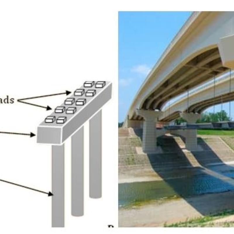
Unmanned aircraft UAVs are mostly used for surveying in the architectural, engineering, and construction (AEC) sector because of their compact size, ease of movement, and the quantity of data provided by integrated sensors. Their application is therefore flourishing in several AEC industries, such as for the monitoring and inspection of engineering facilities like concrete bridges. Alignment surveying is the process of determining the precise location and orientation of the engineering structures in relation to a reference system and is a critical aspect of bridge maintenance and construction. To guarantee that the construction meets the required criteria for quality, overpass bridge engineering checks are still conducted utilizing on-site, extremely precise surveying equipment. Using total stations to measure the bridge pier caps' centerline fittings is a vital yet time- and labor-intensive application.
By exploring the potential use of UAVs for this interesting engineering application, the research aims to contribute to the development of new and innovative approaches for bridge management. In this research proposal, you are expected to run data analysis by using a sequence of processes on the UAV-derived point clouds of the bridge concrete pier caps to finally extract the pier pads center and check the accuracy and reliability of UAV-based alignment compared to traditional techniques. Furthermore, you can run a cost-benefit analysis by evaluating the potential cost and time savings of using UAVs for alignment surveying, compared to traditional techniques. This could involve estimating the cost and time required for both approaches, and comparing the results. And finally to study the limitations and challenges as well as any necessary improvements or adaptations.