Conservation drones: evaluation of sensors and methods for animal detection, distribution and population estimation
A network of wildlife cameras (camera traps) is currently being set up to estimate the population of wild boars in Engbertsdijksvenen National Park. Camera trap data analysis can be part of the research.
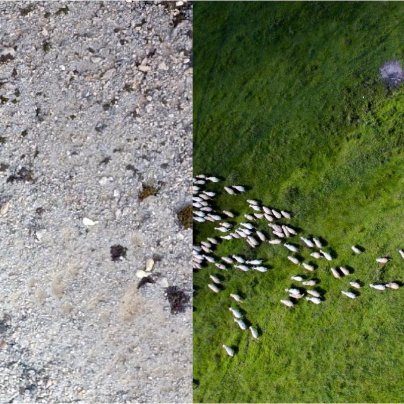
A key task for conservation science is to collect accurate and precise data on animal distribution. Depending on the purpose of the study such information can be used in a number of applications such as population size, density estimation, assessment of habitat preferences etc. A number of methods have been used to try to achieve that goal, but all are costly and time-consuming. Aerial surveys with manned aircraft face high costs, limited availability and increased risks. Ground surveys on foot or by car often have the disadvantage that in large areas there are considerable amounts of time and costs associated with reaching survey locations. Furthermore, animals sense human presences and avoid being detected.
Drones caring cameras are increasingly used in wildlife studies. Detectability is dependent on a number of factors related to the sensor, the flight parameters and conditions as well as the animals in question and the landscape they inhabit. Two of the known issues hindering detectability of animals in their natural habitat are a) the low contrast between the animal and its environment and b) the presence of vegetation offering cover to the anima under investigation.
The proposed research topic aims to compare different methods for animal detection using RGB and thermal cameras on UAV. Depending on the intended focus one of the following applications can be investigated: the alpine zone of the White Mountains of Crete (low contrast between the landscape and free-ranging animals), wildlife in forested areas or grazers in a rangeland area in the Netherlands. Interested students are encouraged to review the literature an address knowledge gaps on the subject. Research questions can include the evaluation of video vs imagery for detection, comparison of various flight parameters, comparison of sensors or models for population estimation etc.
Wich, S. A. and Koh, L. P. (2018). Conservation drones: mapping and monitoring biodiversity. First edn. Oxford: Oxford University Press. (Available at ITC library)