Modelling accessibility/access to food
No fieldwork. Suitable students should be comfortable working with R. Single country, multi-country and even global analysis is possible with this topic.
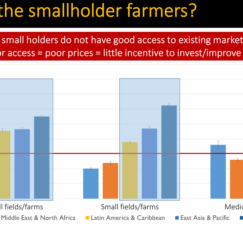
Good access to resources and opportunities is essential for sustainable development. Improving
access, especially in rural areas, requires useful measures of current access to the locations where these resources and opportunities are found. Physical access – measured by travel time, distance, cost – is one of the dimensions of food security. Recent work has shown that travel time (such as the time required to travel from home to school, or from a farm to market, or from home to a market) relates strongly to inequality in livelihoods. Those with better accessibility to resources generally have a higher level of wellbeing.
This MSc thesis topic will use recently developed raster and/or vector-based representations of food networks, production zones and consumption patterns. There is freedom to choose the country (or countries) for this study depending on the exact question developed by the student and the available secondary data.
This MSc thesis study will use recently developed tools for modelling spatial accessibility to explore the spatial patterns of access to crops (production) or food (consumption), and their implications to society.
Nelson